


by David Jeffreys - June, 2009 ©
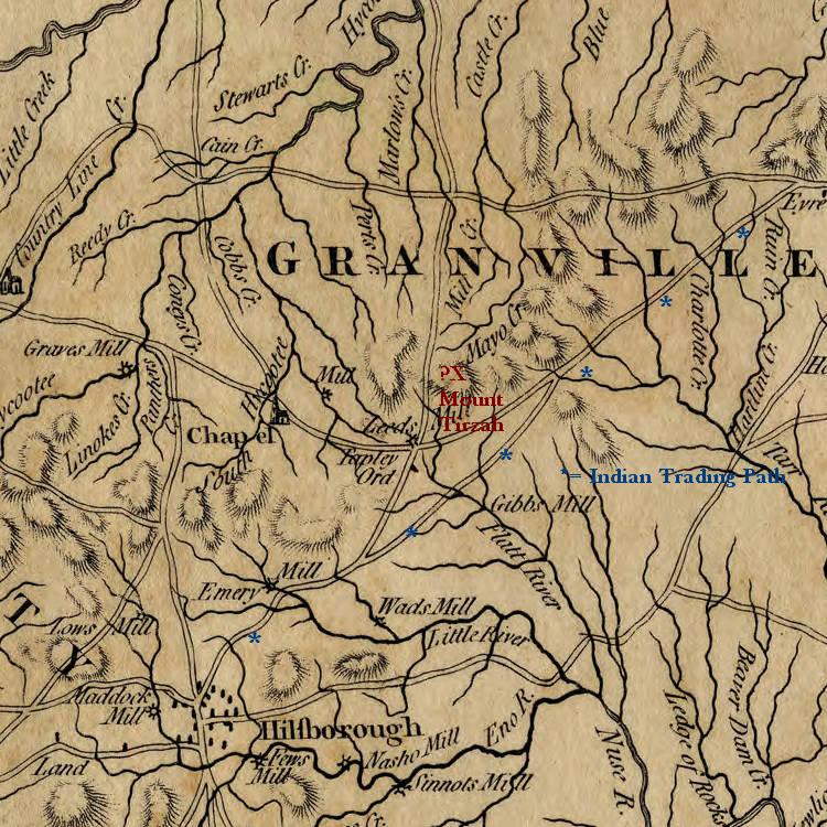
Stephen Moore had a mill on the Flat River that had previously been named Gibbon's Mill. Mills were a common location for the surrounding community to come together for not only milling their corn and wheat, but to swap stories, get the news, and even advertise for their needs.
Traveling north on US 501 from Durham, you will cross the Eno River, where the West Point Mill is located. It is now a park -- West Point On the Eno, and after rebuilding the fallen mill on the old site, the mill is operational once again. More on this later. For more information on this mill visit: http://www.enoriver.org/eno/parks/WestPoint/westpoint.html and http://endangereddurham.blogspot.com/2009/02/mccown-mangum-house-west-point-mill.html
Travel further north, and you will cross the Little River Reservoir. The Eno, the Little, and the Flat Rivers combine to form the Neuse just to the east on the former plantation of the Bennehans (Stagville) and Camerons (Fairntosh). Stagville is now a NC State Historical Site, which you can visit.
Travel further north still until you come to Quail Roost on your left, turn right onto Moore's Mill Road. This road also runs north-south and parallels US 501. You will cross Red Mountain Road and continue north and pass into Person County where the road begins to parallel the Flat River and is subject to flooding when the Flat rises out of its banks. Then you will cross the river on a bridge, and the original Moore's Mill site is just to your left, but there are currently no remains. In 1976, the Durham Morning Herald did a wonderful article on the mills of Flat River with photos by Harold Moore. Here are copies of those photos.


Millard Thacker, a neighbor on the other side of the bridge, told me: "The old wheel was donated by a previous owner (Mark O'Neal) to the ENO RIVER/PARK HISTORICAL GROUP AND IS IN OPERATION AT THE ENO RIVER SITE ON HWY 501, JUST NORTH OF DURHAM." So that puts us back to the West Point on the Eno Park.
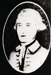
After crossing the bridge, you will begin climbing higher and higher, passing the mountain on which the fire tower is located, and then climbing higher still until you reach the Helena - Moriah Road. This junction is where it is believed that the original Moore Store and Mt. Tirzah post office were located. Turn right and then in a few yards turn left onto the Mt. Tirzah - Surl Road, and you will see the Mt. Tirzah United Methodist Church on your right. Continue climbing to the top of Mt. Tirzah. The Stephen Moore home built in 1778 will be on your right at the top, which now puts the large plantation in context. A mile or so to the east on the Helena - Moriah Road, you will cross Deep Creek, which ran through the eastern part of the Stephen Moore plantation. Deep Creek empties into the Flat River below the mill and near the Person County - Durham County line.
No comments:
Post a Comment